|
Bertness Lab |  |
| Coastal Ecology and Conservation at Brown University |
| Overview |
| Consumer control |
| Human impacts |
| Foundation species |
| Climate change impacts |
| Historical ecology |
| Mark Bertness |
| Lab Alumni |
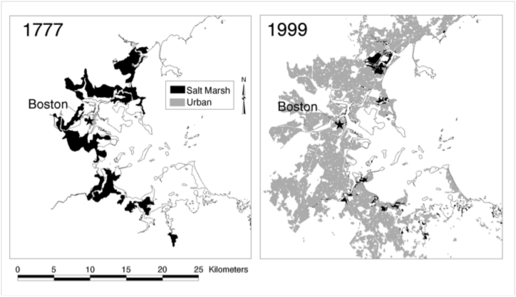
Historical states of impacted ecosystems Recently we have incorporated the tools of historical ecology into our research to understand the history of human impacts on salt marsh ecosystems. Salt marshes are ideal for historical reconstruction research because they are relatively simple landscapes with strong plant zonation that is easily quantified from archived aerial photographs that are generally available every decade from the 1930s to the present. Earlier data on salt marshes can be extracted from historical maps often available from the colonial era. Using these techniques Keryn Gedan, now a Smith Fellow at the Smithsonian Environmental Research Center, was able to calculate the loss of salt marshes to human activities since the colonial era. Currently, Lauren Szathmary is using historical reconstruction of marshes with archived aerial images to explore the linkage between latitudinal variation in climate and salt pan development and Tyler Coverdale is using historical reconstruction of Cape Cod and Long Island Sound salt marshes to examine the linkage between shoreline recreational fishing infrastructure and grazer-driven salt marsh die-off. Salt marsh loss in Boston, Massachusetts, since the colonial era (from Bromberg and Bertness 2005). References |
